El Hierro, Canary Islands: the edge of the old world

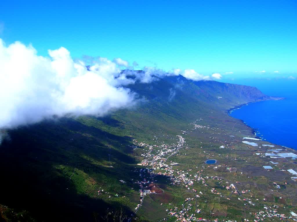

El Hierro is the kind of place that exists more convincingly as geology than as civilization.
I have not been there. I have been reading about it for three weeks, toggling between volcanic stratigraphy papers and grainy YouTube footage shot from ferry decks, and what I keep returning to is how the island resists the frame I want to put on it. Most travel writing treats landscape as backdrop. El Hierro won’t cooperate. Around twelve thousand people live there. There is one traffic light, controlling a tunnel. The capital, Valverde, is the only Canary Island capital that sits inland, up on a ridge instead of facing the harbor, as if even the town wanted to be closer to the rock than to the sea.
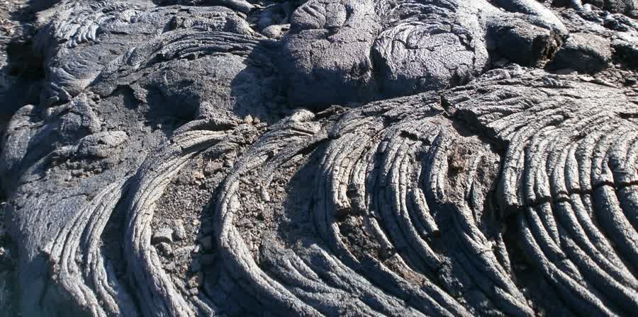
The island is the smallest of the seven main Canary Islands and the youngest, which in geological terms means it is still arriving. Where Lanzarote and Fuerteventura have had millions of years to erode into sandy plateaus, El Hierro is just over a million years old, still sharp, still pocked with over five hundred volcanic cones that haven’t had time to soften. The last eruption was submarine, in 2011, off the southern coast. The ocean boiled and turned green with iron and sulfur. Residents of La Restinga were evacuated. Beneath the surface, the submarine volcano Tagoro rose from roughly 350 meters depth to about 90, piling new material on the seafloor without ever breaking the waterline. The island grew, measurably, in ways only sonar could confirm. This is not metaphor. The ground is literally unfinished.

What I think about most is the western escarpment called El Golfo.
Tens of thousands of years ago, the entire northern flank of the island collapsed into the Atlantic in one of the largest known landslides on Earth. What remains is a crescent-shaped amphitheatre, a vertical wall of basalt curving for kilometers, open at its base to the ocean. The scale is hard to process from photographs. The cliff face drops 1,000 meters. The debris field on the ocean floor extends over 60 kilometers from shore. Standing at the rim (I imagine standing at the rim) you would be looking down into the scar of a mountain that simply fell sideways into the sea.
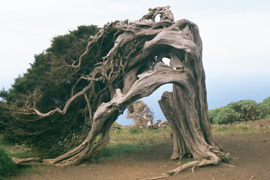
The sabinas are the other image I can’t shake. Juniperus canariensis, a juniper endemic to the Macaronesian islands, and on El Hierro’s western highlands at La Dehesa they grow in shapes that look sculpted, theatrical, impossible. They are none of those things. They are the product of decades of prevailing trade winds pushing from the northeast, bending each trunk and branch into a permanent lean. Some lie nearly horizontal. A few spiral. The wood grain inside must record every year of pressure the way a river-bottom stone records current. I’ve read that some of the oldest specimens are over a thousand years old. A millennium of wind, visible in the twist of a single tree.

Before 1884, El Hierro served as an edge of the measured world. Ptolemy anchored his zero longitude to the Fortunate Islands, the ancient name for the Canaries, in the second century, and a meridian through El Hierro persisted on European maps for centuries, one of several competing prime meridians that cartographers used to orient their grids. The meridian line crossed at the Orchilla lighthouse, Faro de Orchilla, on the island’s westernmost point. A small monument marks the spot now. When the International Meridian Conference moved the line to Greenwich, El Hierro lost its cosmological function but kept the geography that earned it. You can still stand at the lighthouse and face west into open Atlantic with nothing between you and the Americas.
The Bimbache, the branch of the Guanche people who inhabited El Hierro before the Spanish conquest, survived on an island with almost no surface water. Their solution was a tree. The Garoe, a large laurel (likely Ocotea foetens), stood in the highland cloud forest and performed what hydrologists now call horizontal precipitation: fog condensed on its leaves and dripped into catchment basins at its base. The Bimbache built collection ponds to catch the runoff. A single tree, functioning as a municipal water system. The original Garoe was reportedly destroyed in a storm around 1610. A replacement was planted in the same spot in 1949. The catchment basins are still there. I find this almost unbearably elegant. Not the engineering, which is practical enough. The premise. That you could build a civilization’s water supply around the fact that clouds touch trees.
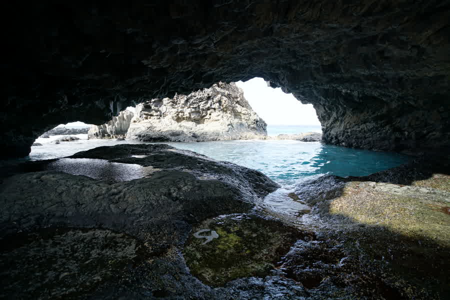
The charcos are what I’d spend my days at if I were there, which I am not, which is the whole problem. These are natural pools formed in basalt at the shoreline, places where lava met the ocean and cooled into shapes that hold water. At high tide the Atlantic floods them. At low tide they settle into calm, enclosed basins, still connected to the sea through cracks in the rock but sheltered from the open swell. Charco Azul has walkways and access points built into the volcanic lip. La Maceta has a series of pools at different depths, with railings and a small restaurant above. Charco de los Sargos is rougher, less visited, the kind of place where you’d lower yourself into dark water and feel the ocean pulse beneath you through fissures you can’t see. The water in these pools is clear in a way that photographs make look exaggerated. It is apparently not exaggerated.

South of the charcos, the sheltered coast opens into the Mar de las Calmas, a marine reserve where the island blocks the prevailing currents and the water goes still. Divers describe visibility exceeding 30 meters. Manta rays. Whale sharks, seasonally. The volcanic substrate drops away in underwater cliffs that mirror the ones above the surface. I don’t dive. I would learn.
In 2014, the island opened Gorona del Viento, a wind-hydro power plant designed to make El Hierro the first island in the world running entirely on renewable energy. The system pairs wind turbines with a pumped-storage hydroelectric reservoir: when the wind blows, turbines generate electricity and pump water uphill into a volcanic crater; when the wind dies, the water flows back down through turbines to keep the grid alive. The island hasn’t hit 100% yet on an annual basis, though individual stretches of weeks have run fully renewable. For an island of around 12,000 people with no fossil fuel deposits, the ambition is proportional to the geography. The crater they use as a reservoir is one of the five hundred.
What holds me is not any single detail. It is the ratio. Rock to people, geological time to human time, silence to noise. Most islands I’ve wanted to visit pull me with culture, with food, with the texture of streets that have been walked smooth. El Hierro pulls me with absence. The land does not need you there. The sabinas bent before anyone was watching and will keep bending after. The charcos fill and empty on tidal schedules that have nothing to do with tourism boards. The Garoe drips whether or not anyone builds a channel beneath it. I want to go to a place where the ground is the protagonist and I am, at best, a minor character walking across it.
I will probably go in winter. The off-season, if a place this small has a season at all.
El Hierro lies roughly 1,450 kilometers southwest of mainland Spain, the westernmost and southernmost of the Canary Islands. There is no international airport. You fly into Tenerife (North or South) and connect on a 40-minute inter-island flight with Binter Canarias, or take a ferry from Los Cristianos, which runs about two and a half hours to Puerto de La Estaca. October through March is cooler and less crowded. The bus network covers the eastern towns but not the western coast or highlands, so a car is effectively necessary. Accommodation is limited and books early for summer. The diving season peaks in summer when the Mar de las Calmas is warmest, but the charcos and the sabinas and the volcanic cones do not care what month you arrive.
Sources
- Photo: barraquito, CC BY-SA 2.0 · img/hero.jpg
- Photo: Eckhard Pecher, CC BY-SA 3.0 · img/sabinar-juniper.jpg
- Photo: Areuland, CC BY-SA 4.0 · img/charco-azul.jpg
- Photo: Julen Iturbe-Ormaetxe, CC BY-SA 2.0 · img/lava-fields.jpg
- https://en.wikipedia.org/wiki/El_Hierro
- https://elhierro.travel/en/municipios/valverde/
- https://www.unesco.org/en/iggp/el-hierro-unesco-global-geopark
- https://en.wikipedia.org/wiki/2011–12_El_Hierro_eruption
- https://earthobservatory.nasa.gov/images/76229/el-hierro-submarine-eruption
- https://volcano.si.edu/showreport.cfm?doi=10.5479/si.GVP.BGVN201110-383020
- https://en.wikipedia.org/wiki/Ferro_meridian
- https://en.wikipedia.org/wiki/International_Meridian_Conference
- https://elhierro.travel/en/experiences/discover-the-garoe-the-sacred-tree-of-the-island-of-el-hierro/
- https://en.wikipedia.org/wiki/Ocotea_foetens
- https://elhierro.travel/en/natural-pools/el-hierro/charco-azul/
- https://elhierro.travel/en/natural-pools/el-hierro/la-maceta/
- https://www.goronadelviento.es/en/
- https://www.endesa.com/en/projects/all-projects/energy-transition/renewable-energies/el-hierro-renewable-sustainability
- https://elhierro.travel/en/museums-and-places-of-interest/el-hierro/el-sabinar/
- https://www.arbolappcanarias.es/en/species/info/juniperus-turbinata/